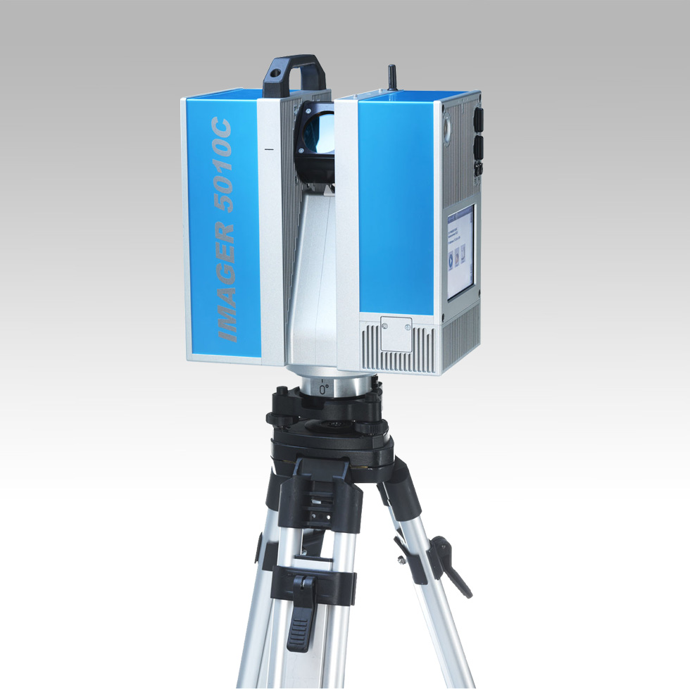
Lidar Z+F Imager® 5010C
The laser scanner technology allows to acquire digital data of all kinds of three-dimensional object. Via a beam of rays L.A.S.E.R. (Light Amplification by Stimulated Emission of Radiation ), deflected by a rotating and swiveling mirror mechanism, the scanner acquires a point cloud representing the object in 3D. Are measured thousands of points per second and each one have measured spatial coordinates (X, Y, Z), the scanner also detects the return time of the laser, giving a descriptive attribute of the acquired surface. Via a camera aligned with the scanner is also acquires a picture of the structure, useful to give the attribute RGB to color the cloud, this is essential for the production of orthophoto and for the operation of Texture Mesh.
The dense cloud of discretized points is transformed into a continuous surface through complex algorithms triangulation ( Meshing ) , in order to provide data more manageable. We can also provide solid models of reality under consideration, digital surface modeling (DSM), land (DTM) and elevation models (DEM) light and easy to use. To obtain this result lighten the flat surfaces, where the data of the thick and dense cloud of points is superabundant, while retaining high detailed and the mesh where necessary, depending on the level of curvature of the object in question.
The mesh thus processed are then textured using images as pictures reworked ( undistorted ) acquired during the scanning due to a professional camera appropriately calibrated and in axis with the tool. The measurement is performed by the tool without the need to affix the detected object (architecture, facing rocky terrain , etc. . ) No passive reflector (prism or reflective surface ), as it requires a lot of topographic total stations.
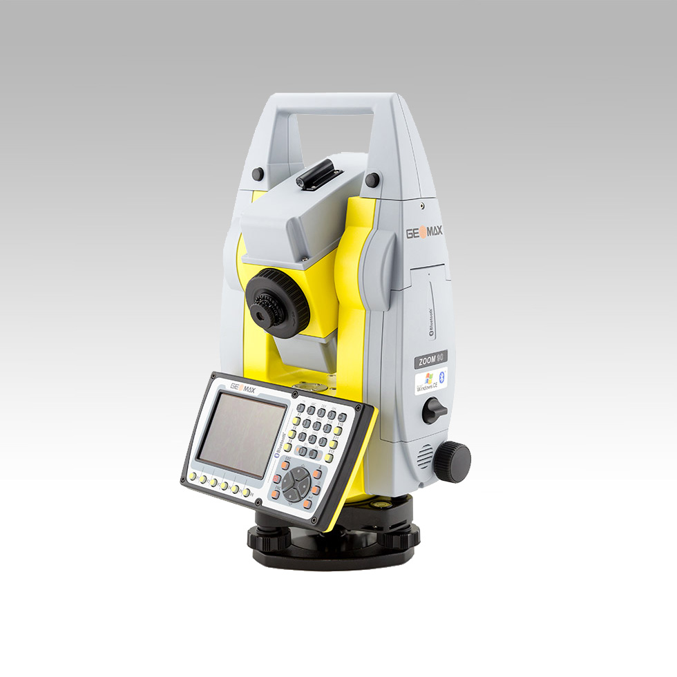
Geo-Max Zoom 90 Series
Dramatically minimise the time of any survey task and boost your performance and accuracy to the maximum.
Zoom90 is the ultimate one-man system with up to 20% more automation performance, extended reflectorless measurement capability, STReAM360, accXess technologies and Windows CE open connectivity.
Because a perfect solution is more than its single components, the Zoom90 seamless integration makes it the ultimate solution.
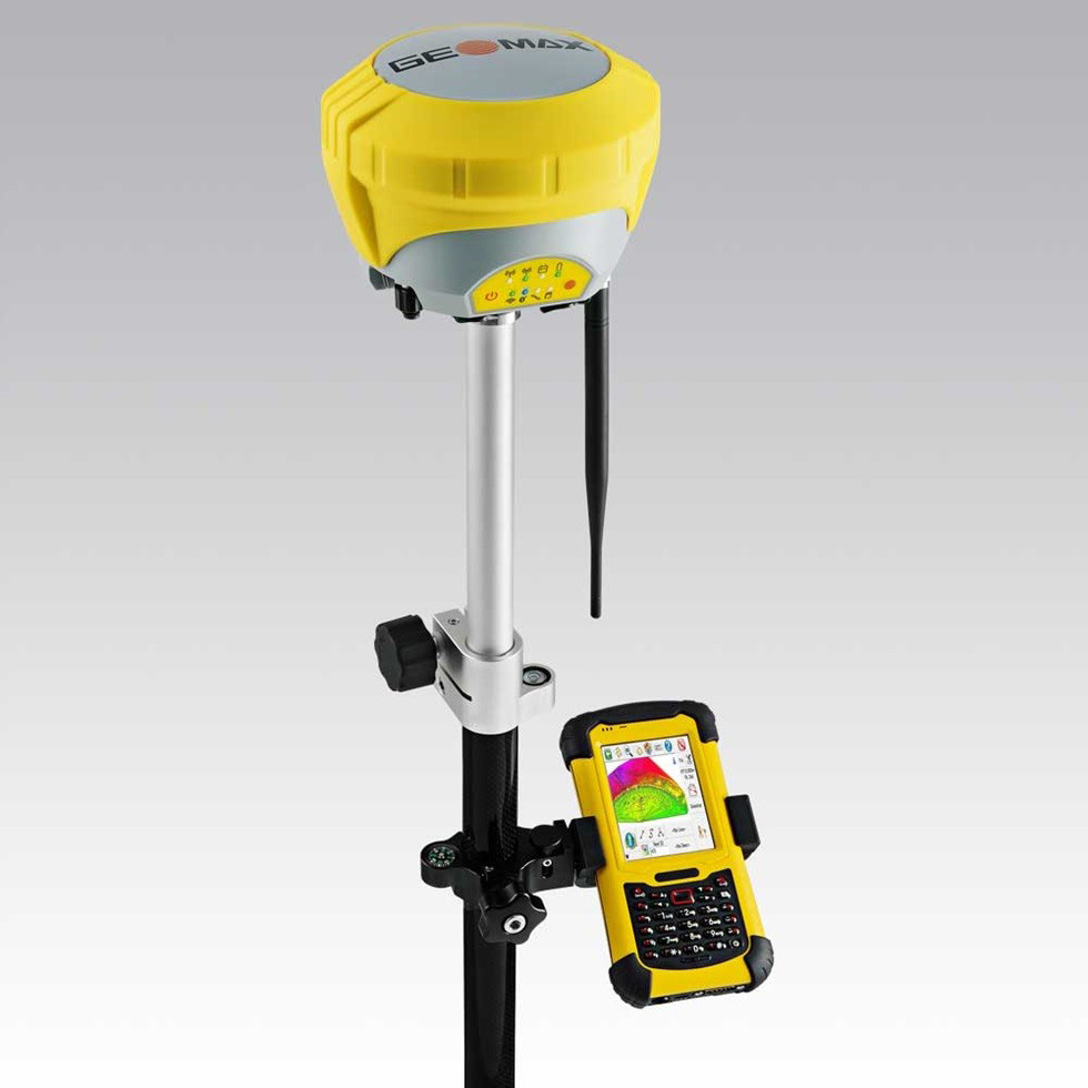
Geo-Max Zenith 35Pro
Full spectrum of satellite signals, unlimited connectivity and the unique Tilt&Go functionality all in a compact GNSS make the Zenith35 Pro series the GNSS that works when you do.
555 CHANNELS
All satellite systems and frequencies supported
NovAtel® technology
Selectable RTK modes
EASY TILT&GO
Reach and measure hidden points with tilted pole
Check & track pole verticality
Precise electronic bubble
COMPACT & RUGGED
Compact size
IP68 water and dust proof
Shock protected
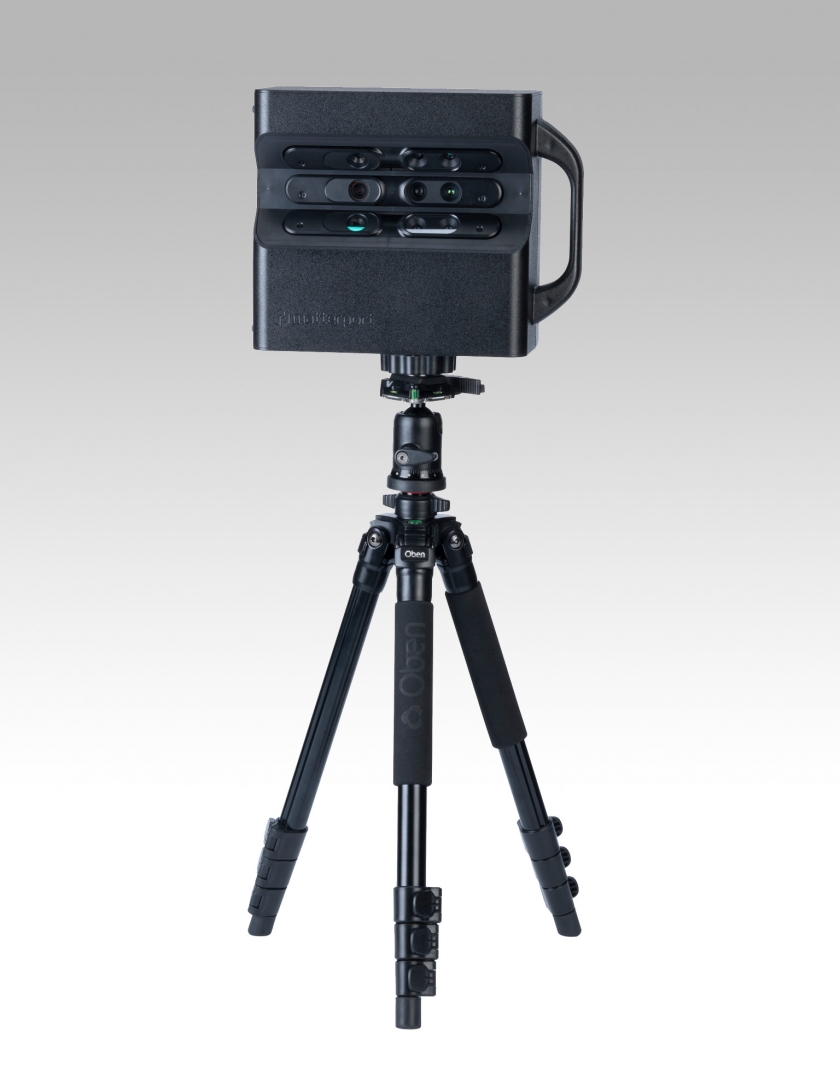
Matterport Pro2 3D Camera
Effortless, high-resolution reality capture, now with 4K photography. You can shoot, edit, and share complete 3D walkthroughs that you can distribute across the web, print, and virtual reality.
All-in-one
With a single scan, you get everything you need to communicate, market, and modify real-world places with your audience.
Detailed 3D Data and Stunning 4K HDR Visuals
Scan a Space
Scan any place with the push-button simple Matterport Pro2 3D Camera. Scanning is lightning-fast, incredibly easy, and fully automated.
Upload to Cloud
Upload your scans to the cloud, where powerful algorithms process your data. In a few hours your Matterport Space is ready to be accessed from anywhere.
Share and Engage
It’s easy to distribute your beautiful, fully immersive Matterport Space. Embed it like a video or provide a link. No downloads or plug-ins necessary!
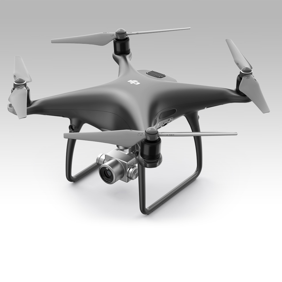
Dji Phantom 4 Drone
Revolutionary Materials and Enhanced Agility
The Phantom 4’s magnesium skeleton reduces weight while keeping stiffness at a maximum to minimize vibration. The new core design lifts the center of gravity closer to the Phantom 4’s heart, improving balance, making it more agile and impressively precise.
Multiple Flight Modes
Switching flight modes to meet your needs, whether you are looking for simplicity and intelligent navigation, speed or smooth cinematic movements is easy.
Fly Far for Longer
Fly for 28 minutes, an increase in effective flight time of 25% from the Phantom 3 Professional. Enjoy 3.1mi (5km) of range, with complete control and a live 720p HD view of everything the camera sees.
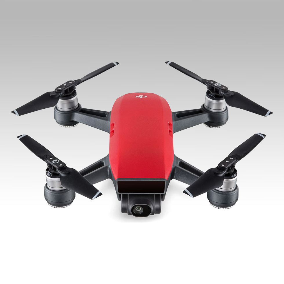
Dji Spark
Meet Spark, a mini drone that features all of DJI’s signature technologies, allowing you to seize the moment whenever you feel inspired. With intelligent flight control options, a mechanical gimbal, and a camera with incredible image quality, Spark empowers you to push your creative boundaries.
Quick Launch
With FaceAware, Spark lifts off from your hand by recognizing your face.
It takes off and hovers in place within seconds of powering on.
Simple Controls
Take amazing aerial photos using just hand gestures, without a remote controller or mobile device.
Create with Ease
Intelligent Flight Modes and intuitive controls help you create cinematic aerial videos with just a few taps.
Edit and Share
The DJI GO 4 app features automatic editing templates and an array of filters. Quickly edit videos and share them straight to social media.